worldview.earthdata.nasa.gov

별 5개 중 4.0개(리뷰 1개 기준)
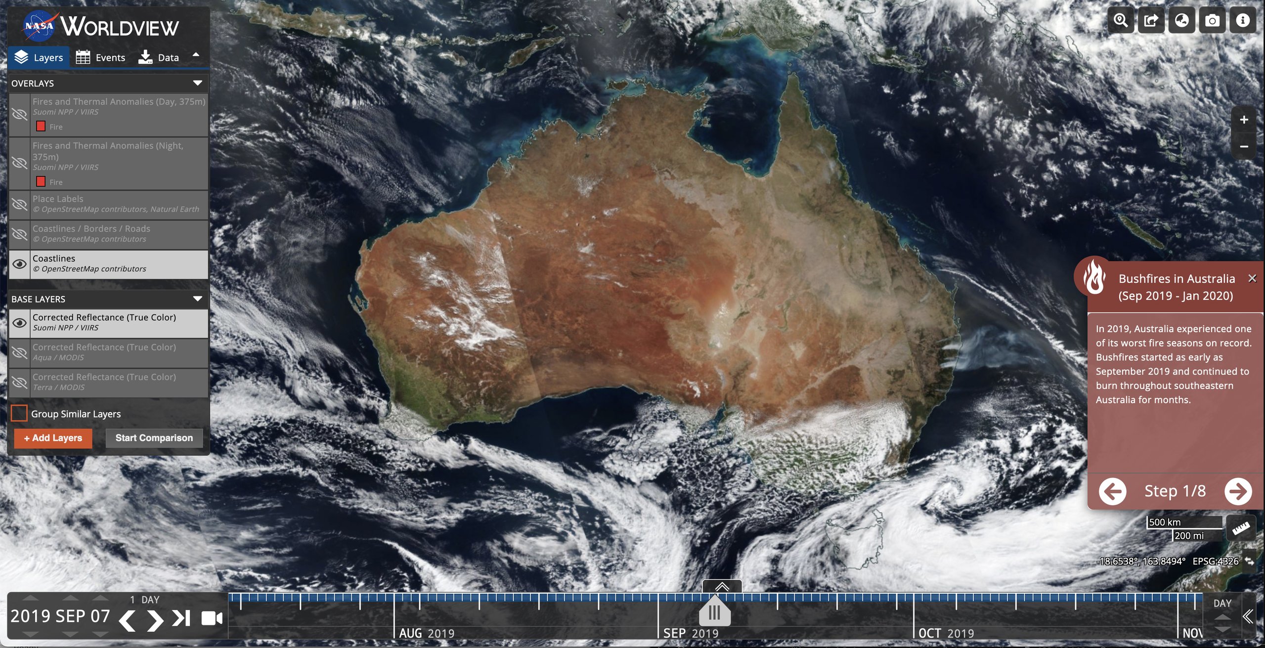
NASA의 EOSDIS(Earth Observing System Data and Information System)의 Worldview 도구는 1000개 이상의 글로벌 전체 해상도 위성 이미지 레이어를 대화형으로 탐색한 다음 기본 데이터를 다운로드할 수 있는 기능을 제공합니다. 많은 이미지 레이어는 매일 업데이트되며 관측 후 3시간 이내에 사용할 수 있습니다. 즉, 지구 전체가 '지금' 보이는 그대로 표시됩니다. 이는 산불 관리, 대기 질 측정, 홍수 모니터링 등 시간이 중요한 응용 분야를 지원합니다. 산불, 열대성 폭풍, 화산 폭발 등 자연 현상 목록을 표시하는 이벤트 탭을 사용하여 현재 자연 재해 및 이벤트를 확인하세요. 시간이 지남에 따라 이미지에 애니메이션을 적용합니다. 이제 정지궤도 이미지 레이어도 사용할 수 있습니다. 지난 90일 동안 10분 단위로 제공됩니다. 이러한 전체 디스크 반구형 보기를 통해 전 세계 대부분에서 발생하는 변경 사항을 거의 실시간으로 볼 수 있습니다. 많은 제품에 대한 북극 및 남극 전망도 "전체 지구본" 관점에서 볼 수 있습니다. 태블릿 및 스마트폰 장치에서의 검색은 일반적으로 이미지에 대한 모바일 액세스를 지원합니다.
하나의 위험 신호는 해당 웹사이트의 추적기 'googletagmanager.com'일 수 있습니다. 그렇지 않으면 이 지도는 무역이 거의 없는 것 같습니다.